7 Fascinating Bird’s-Eye-Views of Florida
Although not necessarily tourist attractions, there are a number of incredibly fascinating views of Florida that won’t be noticed or really appreciated from ground level.
Seeing as it’s doubtful you’ll be able to spot them from the plane on the way in we thought we’d pick a selection of the most intriguing and use Google Maps to point them out for you. If you know of any others equally as fascinating, let us know in the comments.
(If you fancy seeing more, simply click on the photos to be taken to the area on Google Maps itself)
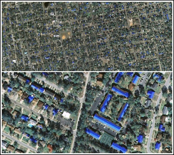
The Blue Rooftops of Pensacola
The blue rooftops in the photos above aren’t a design feature, they’re actually temporary fixtures used to cover roofs damaged as a result of extreme weather conditions, something all too familiar to residents in certain parts of Florida. The ones that can be seen around Pensacola on Google Maps were just some of the tarps administered by FEMA’s Operation Blue Roof during the 2005 hurricane season, one of the worst in recorded history.
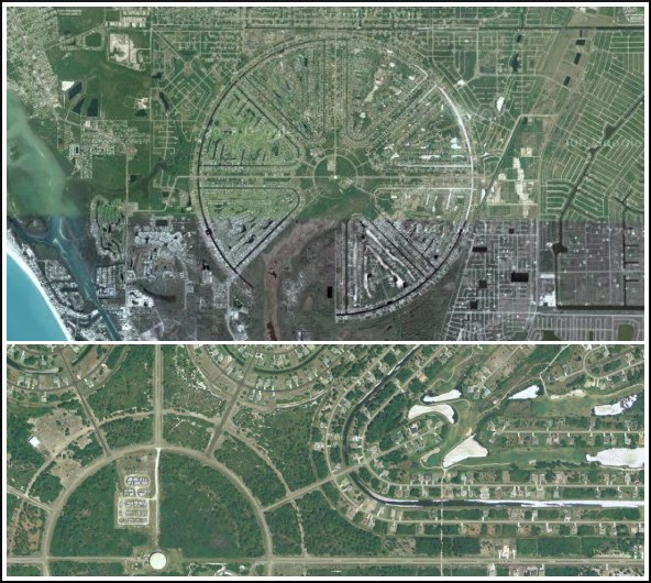
The Disc of Rotonda West
After looking at the area from above it’s unsurprising to discover that Rotonda West is a planned community in Charlotte County, Florida, the entire subdivision contained within a huge circle (29km²) which is then surrounded by a river. That circle is split into eight sections, all but one containing housing. The remaining slice is home to a burgeoning nature reserve.
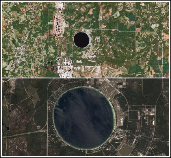
Florida’s Silver Dollar Lake
Known by pilots as Silver Dollar Lake due to it’s near-perfect circular shape (a characteristic which has, unofficially at least, gained it the title of Most Circular Lake in the World), this 3km diameter lake is located in Clay County, Florida. Although no-one can be certain, the general consensus is that the lake was formed as a result of a sinkhole, mainly due to it’s shape and the nature of its sloping floor.
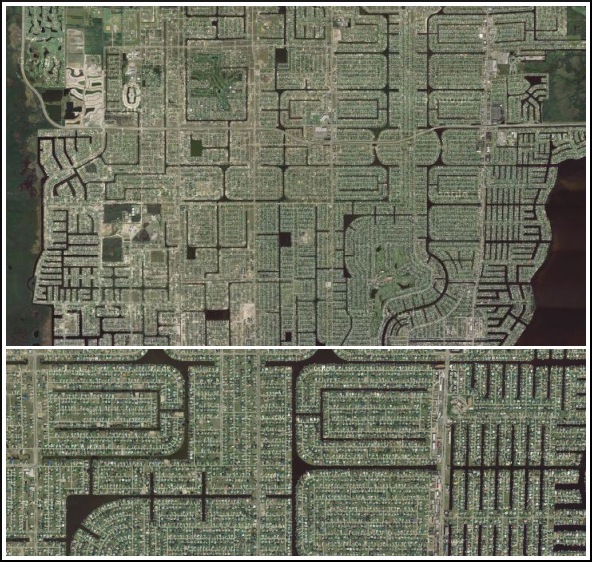
The Coral of Cape Coral
Cape Coral, with a population of just over 100,000 people, sits amongst over 400 miles of canals. It’s a beautiful area, even more so when you take a look from above and notice the amazing patterns created by the network of meticulously planned waterways. The area’s name suddenly begins to make sense.
Turkey Point’s Enormous Cooling Radiator
The close-up in the lower section of the picture above shows a portion of Turkey Point’s Nuclear Plant (which we’ve highlighted in the top section). That should give some sense of scale when looking at the gigantic system of 36 canals used by the station to cool water used within the complex – water which travels along a 136 mile journey through these canals for 2 days before being re-used.
Avon Park’s Gigantic Bombing Target
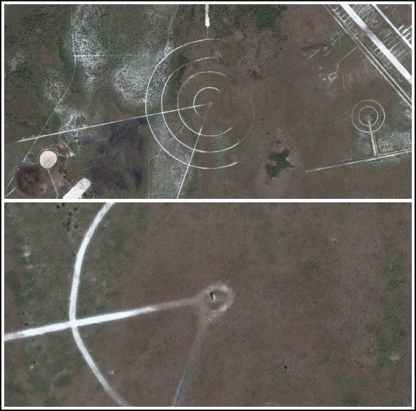
Avon Park Air Force Range, opened during World War II, was at one point the world’s largest bombing range. It’s no surprise then that this humungous bombing target can be clearly spotted using Google Maps, a facility used to train B-17 air crews in air-to-ground bombing. We’re not sure if you’ll be able to visit the target itself but some parts of the park are open to the public.
Mickey’s Forest
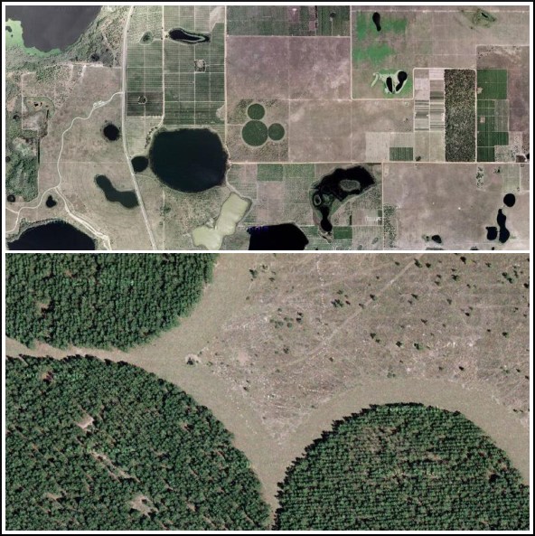
In 1992 it was announced by Disney that they were to begin reforesting parts of Florida in an effort to give something back to the area. The furthest they got was to plant Mickey’s Forest (above), a collection of 50,000 pine trees shaped in a way that should be familiar to the majority of people reading this. Surprisingly it’s relatively unknown to tourists and locals alike.

